


Projet sommet du Gros Ferrant

orsel
User GUIDE
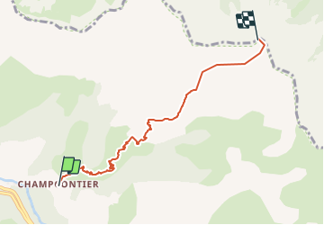

Length
5.7 km

Max alt
2377 m

Uphill gradient
1195 m
Km-Effort
17.7 km

Min alt
1184 m

Downhill gradient
11 m
Boucle
No
Creation date :
2021-11-09 16:31:16.086
Updated on :
2021-11-09 16:32:23.609
4h00
Difficulty : Easy

FREE GPS app for hiking
 SityTrail
IGN / Geographical institutes
SityTrail Plus
The world is yours!
About
Trail On foot of 5.7 km to be discovered at Provence-Alpes-Côte d'Azur, Alpes-de-Haute-Provence, Le Lauzet-Ubaye. This trail is proposed by orsel.
Positioning
Country:
France
Region :
Provence-Alpes-Côte d'Azur
Department/Province :
Alpes-de-Haute-Provence
Municipality :
Le Lauzet-Ubaye
Location:
Unknown
Start:(Dec)
Start:(UTM)
294684 ; 4924711 (32T) N.
Comments